|
Conservation
status: Listed for use as 'Open Space' in the URA
Master Plan 2008, i.e., "Area to be used or intended to
be used as open space" and listed as 'Park/Open Space' in Parks
and Waterbodies Plan.
Mentioned in the Singapore
Green Plan 2012 under "Marine Nature Areas":
"Singapores
surrounding waters bustle with large ships and small all hours
of the day, but thanks to effective pollution control, they also
teem with a rich variety of marine life.
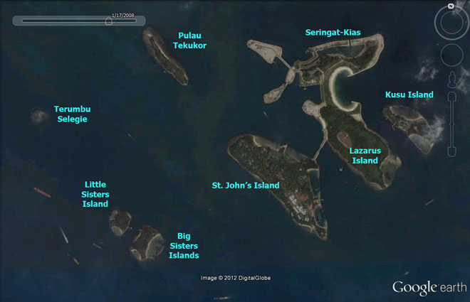
Among our marine treasures are the pockets of coral reefs which
flourish to the south of Singapore, in particular around the St
Johns Island Group, Pulau Hantu, Pulau Semakau and the Pulau
Sudong Island Group. At these marine nature areas, numerous biological
communities - corals, sea-grasses, fishes, mangroves, marine mammals,
plankton and others - live in an abundance of aquatic harmony.
They are a never-ending source of wonderment to divers from Singapore
and elsewhere.
The government will keep these areas in their natural state for
as long as possible."
Current
conservation activities: The Tropical
Marine Science Institute has facilities at St. John's Island
for marine studies and conducts public
outreach activities there. The intertidal area is also regularly
surveyed by wildsingapore.
History: Sir Stamford Raffles was
believed to have first anchored off this island before taking a
smaller vessel to land on the main island. In the 1930's it became
a major quarantine station for the large influx of immigrants. Later
it was used as a penal settlement for political prisoners and ringleaders
of secret societies. In 1975-76, reclamation by PSA at St. John's
Island enlarged it by 4ha and it was developed for recreational
use with the setting up of holiday camps, chalets and sporting facilities.
St. John's Island currently houses several government facilities,
but there are still portions of the island accessible to the public.
|
|
About
the name: St. John's Island was originally
called Pulau Sakijang Bandera: Sa=One; Kijang=barking
deer; Bandera=a flag. The current name could have
been derived from when it was used as a quarantine. |
|
|