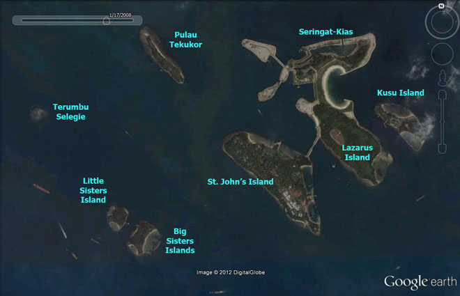
Pulau
Tekukor
Habitats:
Natural rocky cliffs with some coastal vegetation, rocky shores. Flats
rubbly with sparse reefs, some seagrasses.
|
|
Conservation
status: Listed for use as 'Sports and Recreation' in the
URA
Master Plan 2008, i.e., "Area to be used or intended to be
used mainly for sports and recreational purposes." Status not
indicated in Parks
and Waterbodies Plan. It is managed by Sentosa
Leisure Group.
Current conservation activities: It
is sometimes visited for scientific studies.
History: The island was formerly
used as an army dump which has since been closed in the 1980's.
|
|
About
the name: Pulau=Island; Tekukor=Dove.
It was previously also known as Pulau Penyanbong. Penyabong=Joined
together. |
|
|
| Blog
posts about Pulau Tekukor on wild shores of singapore and
the Hantu Blog |
|
|
|
|