 |
|
|
main index to Singapore's Southern shores
for the southern
expedition | mega marine survey blog
| facebook
page
|
| Pulau
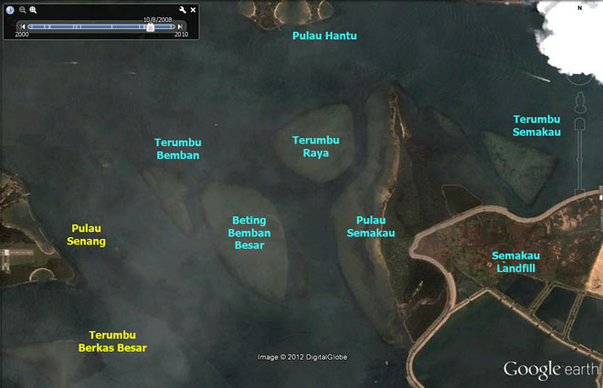
Semakau Western shore habitats (2.5km x 400m) Sandy shores, seagrass meadows, rubble with fringe of sparse corals. Eastern shore habitats (1.5km x 100m) Sandy shores, mudflats, rubble with fringe of sparse corals. In the middle (about 15ha), original mangroves with mudlobster mounds and a possible hot spring, coastal forest, secondary forest. |
|
 |
|
Conservation
status: Listed for use as 'Open Space' in the URA
Master Plan 2008, i.e., "Area to be used or intended to
be used as open space". Status not indicated in Parks
and Waterbodies Plan. Access to Pulau Semakau is managed by
the National Environment
Agency that runs the Semakau
Landfill.
Current conservation activities:
History: In 1999, when the last remaining landfill on Singapores mainland was exhausted, the Semakau Landfill was created by enclosing part of Pulau Semakau and all of a small adjacent island (Pulau Sakeng) with a rock bund. All of Singapore's waste now ends up in this Landfill, i.e., ash from the incineration plants and all non-incinerable waste. The parts of Pulau Semakau that was not destroyed remains natural. |
|
| Landscape views of Pulau Semakau from wildsingapore flickr |
| Highlights of marine life at Pulau Semakau from wildsingapore flickr |
| All photos of Pulau Semakau from wildsingapore flickr |
| Blog posts about Pulau Semakau on wild shores of singapore |
|
Links
|